


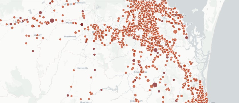
An analysis of 10 years of Queensland Government data has found six of Logan’s 25 highest-ranked crash sites sit along Kingston Road.
Springwood personal injury lawyer Sean Roche built the Queensland Road Danger Map using Department of Transport and Main Roads data after finding there was no simple, up-to-date public tool showing where crashes were concentrated.
His map brings together map crash locations across Queensland and tracks whether the frequency of crashes at each site have increased, decreased or remained consistent.
Together, the intersections at Wembley Road, Compton Road, Chambers Flat Road, Monash Road, Curban Street and Ferguson Street recorded 228 casualties, including three deaths, over the decade to June 2025.
But Mr Roche said it was the recent data that concerned him most.
“When I looked at only the last three years, that’s when Kingston Road really stood out as an outlier,” Mr Roche said.
“Things aren’t getting better there. They are worse than they’ve ever been over the last 10 years.”
The intersection of Kingston Road and Curban Street at Underwood recorded 42 casualties across the decade, with 29 occurring from 2023 onwards.
The map recorded four casualties there in 2023, seven in 2024 and 18 during the first half of 2025. Most recorded crashes were angle crashes.
Mr Roche said behind many crash statistics was an injury that compensation could not undo.
“My job is to get people compensation. I can get them some money, but I can’t take their injuries away,” Mr Roche said.
“No one really wants to have a compensation claim. They do it because they’re in severe pain, they can’t work and they can’t pay their rent.”
Mr Roche said while the government already published the information, it was difficult for ordinary drivers to interpret.
“No one’s going to download a CSV spreadsheet, find GPS coordinates and try to interpret trends themselves,” he said.
The raw data also required significant cleaning because the same intersection could appear under different street-name combinations.
Once the locations were consolidated and mapped, Mr Roche said the concentration along Kingston Road became much clearer.
“The data speaks for itself — crashes happen on Kingston Road,” he said.
“The ‘why’ is a question for the engineers, and ‘how’ we fix it is also a question for them.”
Member for Waterford Shannon Fentiman raised the Curban Street intersection in Parliament in December 2025, asking when a “long-awaited turning signal upgrade” would be delivered.
Some of the other listed intersections have undergone works too recent to be reflected in the decade-long figures.
Mr Roche’s rankings are not official government black-spot rankings and are not adjusted for traffic volumes, meaning heavily used arterial roads may appear more prominently.
But he said the figures still showed where crashes had repeatedly caused serious harm.
“Injuries are permanent,” he said.
“Not every injury can be fixed. Not all of them heal. Avoidance is number one.”
Mr Roche’s website is viewable at: rochelegal.com.au/road-safety/
Subscribe to stay up-to-date with news from across Logan. You’ll receive a link to our digital newspaper direct to your inbox each week. It’s free.
Follow MyCity Logan on Facebook and Instagram